Research topics
Our research topics are as diverse as the researchers at our chair. Nevertheless, there are some areas of special interest to us...
Sediment transport in the landscape
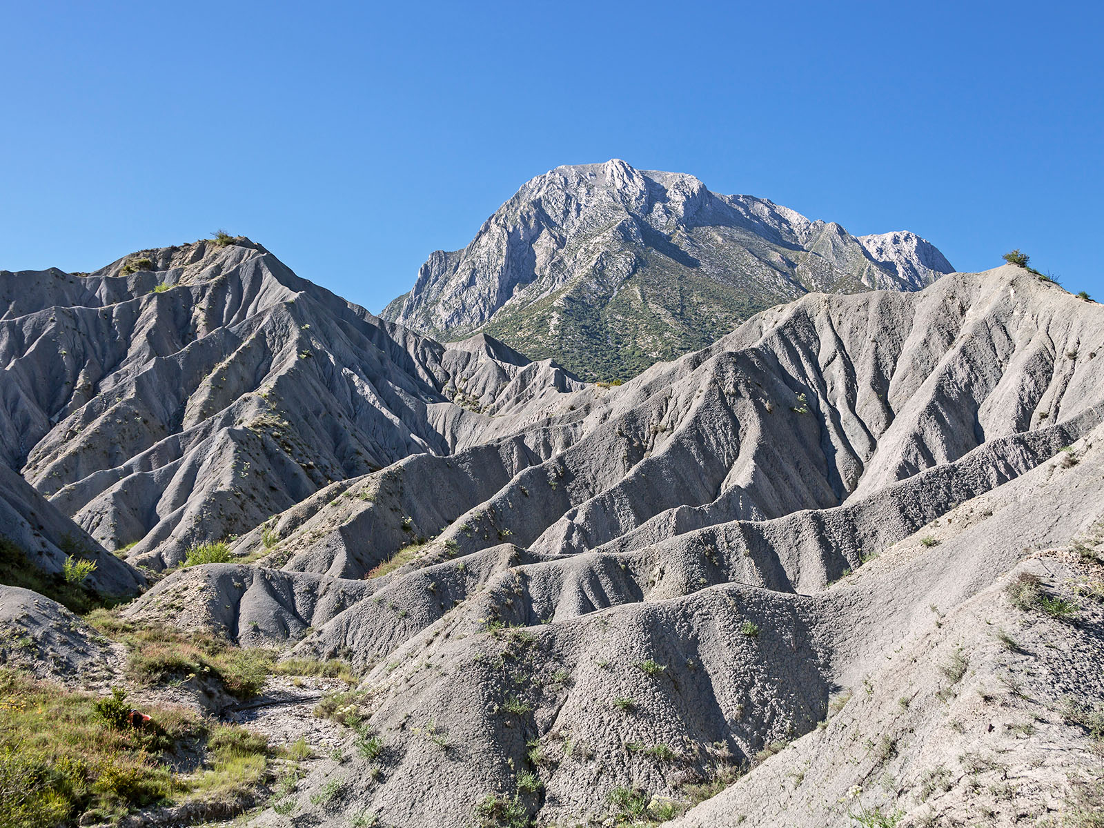
"It rains, it rains, the earth gets wet..." and often not only that: Especially during heavy precipitation and in areas with little vegetation, "the earth" (more precisely, sediments) sets off on its own way! Sometimes only a few centimetres to the field boundary, but also to the next watercourse and from there also further stretches, e.g. to the next reservoir. This not only results in soil loss on site, but can also cause a whole range of other problems (e.g. transport of pollutants, threat to habitats and infrastructure, loss of storage space in reservoirs, ...). At our chair we measure erosion and sediment transport in different regions. We use the understanding gained in this way in order to map these processes in simulation models for complete river regions.
Especially for sensitive regions, human influence - e.g. due to climate change or changes in land use - can have critical consequences. High mountain landscapes are particularly sensitive: In the Alps, we are investigating how the water cycle is changing and will change in the future at different altitudes and eco-zones. This involves the complex interplay of evaporation and regional warming, runoff formation in glaciated or snow-dominated areas and increasing sediment discharge as a result of melting glaciers and thawing permafrost soils.
Contact: Dr. Till Francke, Prof. Dr. Axel Bronstert
Radar-supported precipitation remote sensing
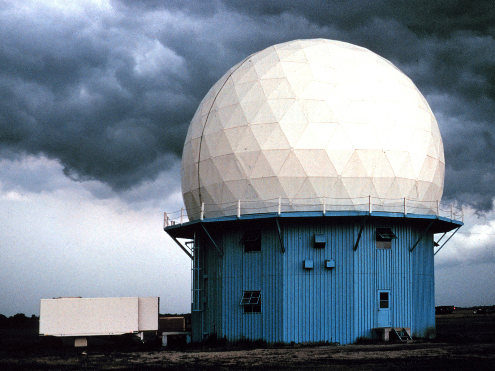
How do you measure precipitation? What at first glance does not sound like a research question of the 21st century is still one of the most burning issues in hydrometeorology. Beyond the conventional approach of placing a collecting vessel in the field, a variety of technologies are available for exploring the atmosphere with high spatial coverage and resolution. Radar remote sensing - whether terrestrial or satellite-based - is of particular importance here. With the free and open source software library wradlib , we have co-developed a product that enables researchers and users all over the world to use these technologies efficiently and effectively.
Contact: Dr. Maik Heistermann
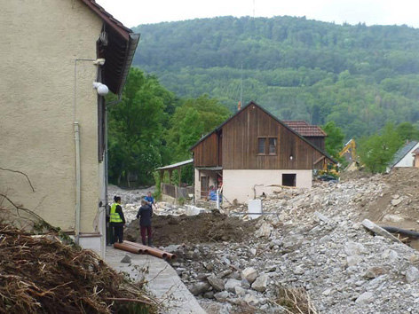
Understanding and predicting flash floods
Flash floods occur as a reaction to short and violent extreme precipitation. They are among the most damaging events and can occur anywhere where runoff quickly concentrates in the landscape. However, their prediction still poses one of the greatest challenges for hydrological and hydrometeorological research. This concerns the causal convective precipitation as well as the runoff processes and the associated mass transport of debris and sludge. This is why we try to reconstruct flash floods as accurately as possible - and to understand them in this way... hydrological forensics, so to speak!
Contact: Dr. Maik Heistermann
Climate change and extreme hydrological events
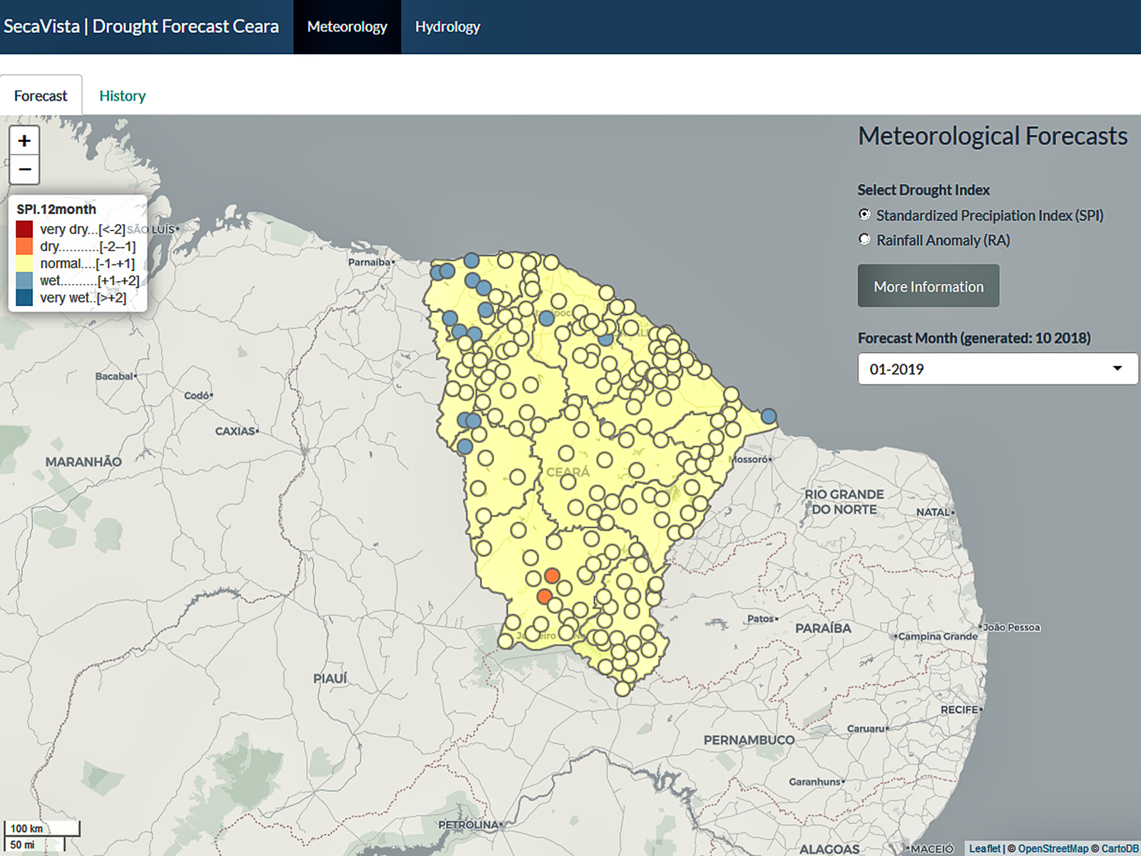
How a changing climate influences our life on earth can be observed in the last few years in the news: Weather extremes such as storms, heavy precipitation or heat waves are increasing in frequency and severity in many parts of the world. We try to analyze whether and to what extent this is the case in specific areas with the help of long-term climatological and hydrological time series. The simulation results of global climate models (GCMs) can also be downscaled to regions using suitable methods, so that seasonal hydrometeorological predictions (e.g. changes in the occurrence of snowmelt in high mountain regions, the severity of the next rainy season in semi-arid regions) or forecasts on a longer time scale are possible.
Contact: Prof. Dr. Axel Bronstert, Dr. Till Francke