GIS resources
Lead
Dr. Gerold Zeilinger

Overview
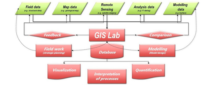
GIS resources consist of hardware and software facilities essential for conducting studies with geospatial data.
A strong focus is on:
- Collecting
- Analyzing and
- Visualizing 3D geospatial data.
Equipment
3D data acquisition is performed by 3D field data surveying with:
- Terrestrial laser scanner (Riegl LMS-Z620)
- Nikon 300D Camera (photogrammetric analysis, stereographic photos)
- Leica Viva GNSS (two rovers, one base)
- 9 Panasonic FZ-G1 MK4 Tablets with GNS 2000-Sensors, Win 10, Field MOVE + ArcGIS
The following hardware and software is available for data analysis:
- Three 3D processing PCs, 3D visualization Planar 2010 M, + PC DELL Precision T5400 4 XEON CPU 2.5 GHz, 8 GB RAM, hard disk 700 GB
- Software (ParaView, ArcGIS, AutoCad, Riegl Laser Scanner software, Kubit (Tachycad, Photoplan, PointCloud, hylasFM), MOVE (academic license information), Fledermaus, Rivertools).
and for the provision and visualization of data:
- GIS Server (ArcGIS Server 10.3) with 10 TB RAID System Dell PowerEdge T630, 32 GB RAM, 2x2.3 GHz, 10 cores, Windows Server 2012
- A0 Scanner Graphtec CS510 Pro + PC 4CPU 3GHz, 1GB RAM, Disk 70 GB, XP 32 bit
- 3D cave visualization and GIS computing
- Scape Pro 55 UHD 3M (4K/UHD Multitouch-Table)
Projekte
| GIS Server Projects (selected Projects using the Institutes Arc-GIS Server/Web Map Portal) |
| Multi-Touch-Tabletop und Smart Digitizing Device (TABGEO), sponsored by European Union and ILB |
| ALErT project: Growing and shrinking lakes on the Tibetan Plateau (K. Korzeniowska) |
| GeoDynALPS (The Alpine Geology from R. Bousquet et al., 2012) |
| Geologic and tectonic map Kohistan (J.-P. Burg/G. Zeilinger) |
| ASPNC Rio Grande Map (Study in Collaboration with GIZ and VRHR, Bolivia; G. Zeilinger, F. Kober and Team, Publication) |
| Landslide susceptibility (including data from Masterthesis A. Ponta & Bachelorthesis M. Liefeld) CBAGS |
| WB Movie "The Afghanistan resource Corridor" short (5 min) or long (10 min) Version (Map sequences done with GIS Server, in Collaboration with PROGRESS) |
| Geologic and tectonic map CBAGS, AGS |
