Prof. Dr. Bodo Bookhagen,
Professor of Geological Remote Sensing: Lidar, Radar, and Optical Cameras
Which sensory methods do you use for your research?
Lidar, radar, and optical cameras.
What are the specific features of these methods?
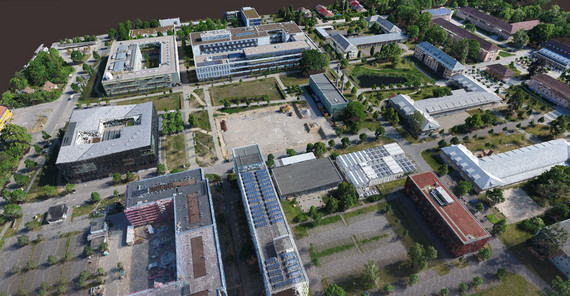
Lidar – an acronym for Light Detection and Ranging – is a rotating laser that can be used on airplanes, drones, or on the ground. At the University of Potsdam, we use terrestrial instruments capable of measuring the Earth’s surface to the nearest millimeter and even of discerning pebbles and detecting grain sizes.
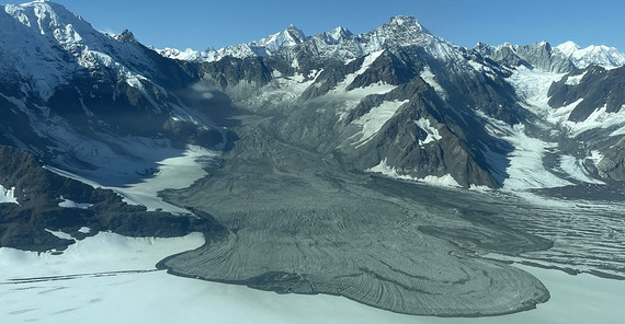
Satellite-based radar images from the sentinel satellites enable us to observe the Earth’s surface with millimeter or centimeter accuracy, for example the stowing after an earthquake or of slow-moving landslides. We work especially in the Central Andes and examine the effects of recent large earthquakes (e.g. in November 2020) or slow-moving landslides that creep downward at several centimeters to decimeters per year.
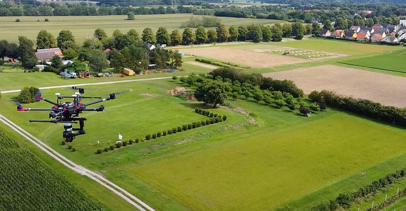
Both devices - lidar and radar - are still relatively heavy and are therefore not usually used on drones. In five years, however, that may already be different. For drone imaging, we mostly use optical cameras that operate in the blue, green, red, and also near-infrared spectrum. With the highly overlapping images, we can create 3D models of the Earth’s surface. While these are not always as accurate as the ones created with lidar data, the images and geographic fields of application are much more flexible.
Lidar data and optical drone images enable the creation of so-called point clouds, i.e., 3D images. With their help, we detect vegetation and biomass, document landslides, and record changes, especially after floods. We also use these elevation models, which possess centimeter-level accuracy, to map tectonic fractures in rock and slow tectonic deformation. These factors play an important role in landscape development on decadal timescales.
On which projects are you currently using these methods?
We are currently working on projects in the Central Andes, the Himalayas, in Central Asia and Namibia. Many analyses, however, are algorithm developments that mostly take place in Golm.
Prof. Dr. Eva Eibl,
Assistant Professor of General Geophysics: Seismometers and rotational sensors
Which sensors do you use for your research?
We use seismometers and rotational sensors for my research.
What are the specific features of these methods?
These instruments measure the ground motion at a specific location. To protect them from strong temperature fluctuations or wind noise, we usually bury the instruments about 20 - 50 cm deep in the ground. Seismometers are very sensitive instruments and can easily record ground motion as fine as a human hair. We use them to measure ground motion along three axes (x, y, z). Rotation sensors measure rotation around the same three axes. We use both types of instruments to “hear” subsurface processes that may produce earthquakes or even longer-lasting signals such as tremor.
In which projects are you currently using these methods?
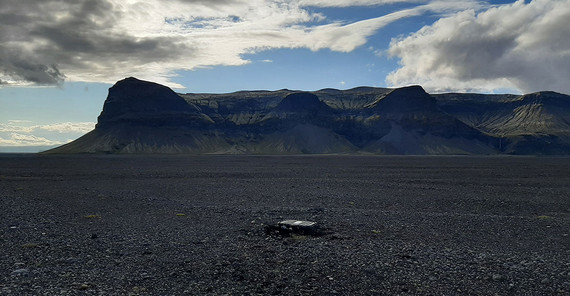
We are currently analyzing seismological signals which are generated by floods in Iceland to understand their movement and accompanying physical processes. Floods moving under the ice generate weak seismic signals. To better “see” them, we install clusters of seismometers at distances of 300 - 1000 meters to each other as a so-called array. We can then stack the ground motions to enhance the signal and reduce the noise. We are also able to determine the signal’s direction and track the process locally. We use arrays to better understand the seismic signals generated by floods under the ice. Since these processes occur under a thick layer of ice, this is the only way to understand how a flood starts, how the water moves, and how it deals with obstacles. We suspect that these signals tell us how the ice breaks as the water makes its way and lifts the ice by approximately one meter. The uplifted region can extend up to 40 kilometers in length and eight kilometers in width in some areas, and in some cases this uplift can last a week. The coastal lowland can then experience flooding due to a runoff of up to 3000 cubic meters per second of water. We have also recently detected signals in a river (outside of the glacier) from rapids that become stronger as the discharge increases. Closer to the river, we would probably also record signals due to the transported material (sand, rocks). That close, however, the instruments would possibly be compromised. Since there are typically many lakes that could generate a flood and which we want to monitor, our instruments are usually located at some distance from the river but strategically positioned in relation to the relevant lakes.
Prof. Dr. Oliver Korup,
Professor for Natural Hazards: Satellite and drone images
Which sensory methods do you use for your research?
We often use satellite-based data which resolve the Earth’s surface with an accuracy of a few meters. Satellite and drone images have become indispensable for accurately mapping individual landslides or recording the areas of thousands of such landslides. We also frequently use satellite imagery to identify which areas are covered with vegetation or used by people. We are also increasingly using temperature and precipitation data to determine whether landslides generally occur more frequently or affect larger areas as a result of rapid climate change. Spatial and temporal patterns of documented landslides often provide information about what triggers or causes them. So part of our research is to understand these patterns well enough to be able to make robust predictions about when and where slopes will become unstable in the future.
What are the specific features of these methods?
We use statistical models due to the large amount of Earth observation data. On the one hand, these models are strongly guided by these observations. On the other hand, they are also able to convey the reliability of predictions in a simple way. As in many other areas, artificial intelligence is playing an increasingly important role in this context, for example when it comes to the automatic and swift mapping of disaster areas. Data-driven models can support extensive fieldwork or provide targeted information. Ultimately, landslides are a widespread but locally very rare natural hazard, and data models help us to assess risks more objectively.
On which projects are you currently using these methods?
We are currently working on studies to determine whether and how the occurrence of landslides due to precipitation differs between urban and rural areas. The landscape and local climate in urban areas have been extensively transformed, so we expect significant differences in critical precipitation values. This could enhance early warning systems for landslides. We are also investigating the protective effect of natural forest vegetation against slope instability. It is sometimes argued in an oversimplifying way that intact forests protect against erosion. However, this is not always necessarily true, especially in mountainous areas. There, we are interested in understanding the limits of this natural protective effect.
Prof. Dr. Sascha Oswald,
Professor for Subsurface Hydrology: Cosmic-ray neutron sensing, abbreviated as CRNS, and local accompanying measurements
Which sensory methods do you use for your research?
Cosmic-ray neutron sensing, abbreviated as CRNS, for determining soil moisture at a landscape scale, and additionally some local accompanying measurements.
What are the specific features of this method?
High-energy particles from space continuously penetrate the Earth’s magnetic field and ultimately produce a natural background of neutrons on the land surface. Since these are uncharged, they penetrate the ground relatively easily. Water, however, holds them back very well. Basically, we use the CRNS probes to count how many neutrons are missing at any given time because the water in the soil has prevented them from getting back into the atmosphere. Each probe measures the fluctuation in the amount of water that is in its wider surrounding. There are three special features that make this measurement unique: First, the probe covers a circular area ranging from 300 - 400 meters in diameter, and multiple measurements are conducted each day – spanning weeks, months, and years. Second, although the probe is mounted above the ground, we can detect water down to a depth of almost half a meter, at least in very dry periods. Third, such a measurement allows us to quantify the average amount of water in the soil, something that would otherwise require a large number of individual local measurements. For an entire study area, we can also get a spatial picture again through a cluster of such probes.
On which projects are you currently using these methods?
We use them in three projects within the DFG Research Group “Cosmic Sense”, whose goal it is to be able to measure soil moisture, i.e. the water currently stored in the soil, even on larger areas. First, the University of Potsdam, which coordinates the research project, centrally provides CRNS technology and operates a stationary cluster of CRNS detectors. Second, UP researchers are working to adapt the CRNS methodology for temporary measurements of larger catchments spanning up to about 100 square kilometers. And third, they are testing the determination of soil moisture in agricultural land with CRNS. In addition, CRNS is also being tested and used in the EU project “SoMMet”, which has just started. The objective of the project is to underpin such measurements of soil moisture with measurement technology ensuring the traceability and harmonization in international and interdisciplinary cooperations.
This text appears in the university magazine Portal Wissen - Zwei 2023 „Exzellenz“ (PDF).


