At the first station, Dr. Clara Nesongano introduces us to the Line-Point Intercept method, also known as the Rapid Ecosystem Assessment Method, due to its efficiency in assessing rangeland conditions. Using a 50m transect, we record observations every 2 meters. The most frequently observed grass species are Eragrostis trichophora and Cynodon dactylon. This method allows us to assess species richness, composition, and diversity.
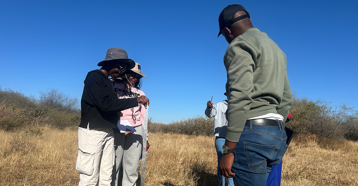
At the second station, Dr. Mark Bilton and NUST PhD student Nali Moyo guide us through vegetation cover estimations. We use a 1m x 1m quadrat randomly placed along a 10m transect to assess plant diversity. Within each quadrat, we estimate percentages and cover for every species. Additionally, we record the heights. We observe how shrubs can create favourable microenvironments for herbaceous species, often resulting in higher species richness and abundance compared to open areas.
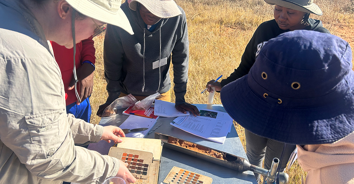
At the final station, PhD student Katrin Zimmer from the University of Bonn introduces us to basic soil assessment techniques. We collect soil samples using a soil auger. We classify the soil using the Munsell Soil Colour Chart and also test the pH-value and measure the soil’s moisture-holding capacity. We learn that soil colour can indicate organic carbon content—darker soils often hold more carbon.
On the way back to the centre, we observe signs of soil erosion, particularly gullies caused by water flow during the rainy season. This is a common occurrence in the area due to steep slopes, rocky terrain, and soil structure.
After a well-deserved lunch, we attend a lecture by Dr. Diego Menestrey Schwieger, a social anthropologist from the University of Cologne. He presents his work on desertification tipping points from a social-anthropological point of view. He challenges us to approach desertification as social scientists by developing our own research questions, methods, and hypotheses. He emphasizes that local communities are often aware of land degradation and have developed their own assessment methods. Drawing from his research as part of the NamTip project, Dr. Menestrey Schwieger shares that while many communities struggle to implement effective grazing plans, they are actively trying to mitigate desertification. His conclusion: fighting desertification is “difficult but feasible,” and collaborative efforts are essential to address these global challenges.
We wrap up the day with a hands-on drone practical exercise led by Prof. Ben Strohbach from NUST. He provides an overview of drone types, applications, and restrictions. After recounting a humorous story about a falcon attacking one of his drones, we launch a fixed-wing drone ourselves. During a 13-minute flight, it captures 114 high-resolution images (3 cm ground resolution), covering an area approximately 1 km long and 100 m wide. We even have the chance to pilot the drone ourselves—with only one crash!
Link to NamTip website: https://www.uni-potsdam.de/en/namtip