Task Force Marche Italy Flood 2022/23


At the end of an extremely dry summer, the Marche region of Italy experienced a heavy rainfall event and flood with approximately half the typical annual rainfall in a matter of hours. What followed was a level of devastation unknown to the region. To learn more, visit our StoryMap, or see the blog post and report below.
Initial Assessment and Field Report
By Lisa Köhler and Heather Murdock
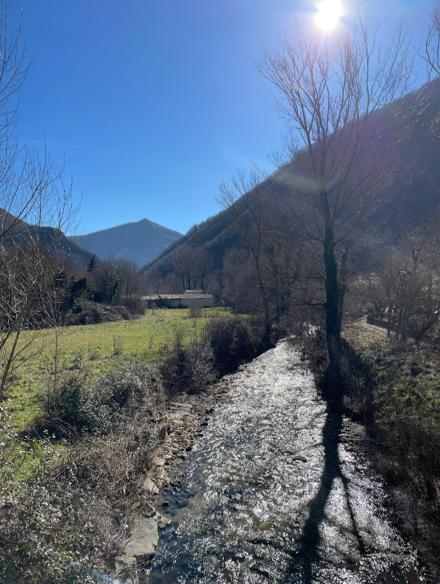
In September 2022, the Marche region in central Italy experienced an extreme weather event, with heavy rainfall exceeding 400 mm within less than three hours. The event triggered a flash flood, resulting in loss of life, extensive erosion, landslides, and significant damage to infrastructure and buildings. In order to understand better the drivers behind the event and the factors contributing to the disastrous consequences, a Task Force of NatRiskChange members was formed. In February 2023, two members of this Task Force went to the field and joined an Italian research team composed of scientists from CNR irpi and the University of Padua. The primary objective of this first field trip was to gain a deeper understanding of the affected region and the flood processes.
Download the full blogpost here.
Field Investigation of Road Impacts
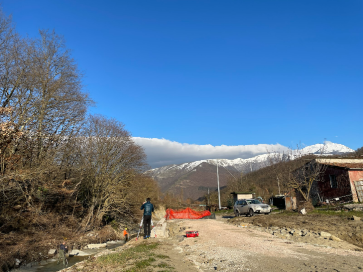
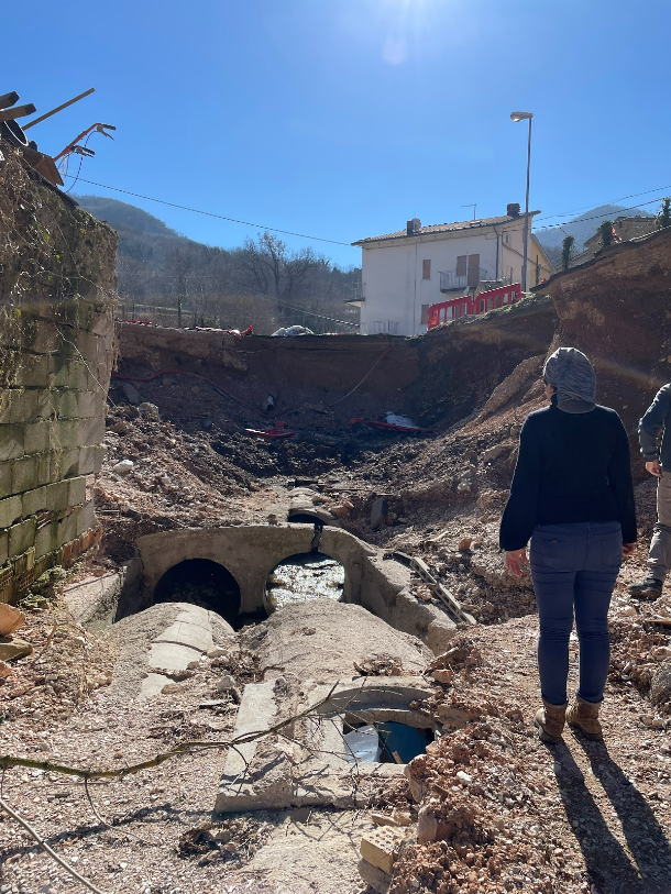
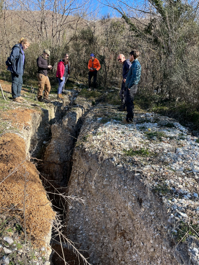
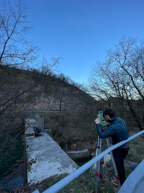
By Paul Voit and Jonas Wassmer
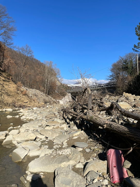
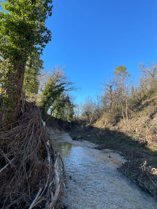
In September 2022, severe rainfall in the Marche region of Italy caused flash floods and landslides, resulting in heavy damages to the road infrastructure and the devastation of small towns and villages. Our goal was to create a dataset of road damages to contribute to the OpenStreetMap community by updating the information on networks in the affected region. To this end, we developed a method that is based on a traveling-salesman-algorithm to traverse the region as efficiently as possible. Then, we mapped damaged and closed roads, as well as bridges using the freely available tool OsmAnd. Our results show that most bridges and houses built above the riverbeds remained intact, while those below the ancient city walls suffered heavy damage. We also found suggestive evidence of woody debris playing a significant role in generating the flood wave, as unrooted trees and floating debris clogged the bridges. The result of the field trip as well as a comprehensive report can be found on GitLab. For future analysis, we suggest a collaboration with local road authorities and the use of digital elevation models for more efficient damage assessment.
Download the full report here.