3D Point Clouds from drone imagery
Bodo Bookhagen
With growing computational capabilities, especially GPUs, improved algorithms, and better workflows, it is now straight forward to generate 3D point clouds from overlapping imagery.
Approaches combining structure-from-motion (SfM) and multi- view stereo (MVS) algorithms allow to create dense point clouds showing the 3D structures of buildings, objects, or virtual outcrops. These point clouds can be explored and analyzed, for example via 3D virtual glasses and can be used to derive cm-scale topography. Airborne and satellite-based lidar provide additional information and multiple returns for each beam for improved vegetation remote-sensing through laser technology.
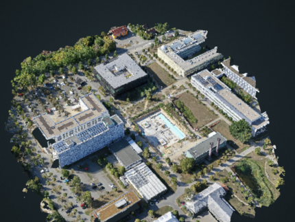
Some examples of past student projects using overlapping imagery include a 3D model of the French Church in Potsdam and the 3D reconstruction of parts of the Campus Golmgenerated from a drone. The latter shows the construction of the new Earth and Environmental Center (to be completed in summer 2022). A classified airborne lidar point cloud shows the Campus Golm. Note: The point cloud viewers allow to change point properties and colors.

