Remote Sensing, geoInformation and Visualization | Master

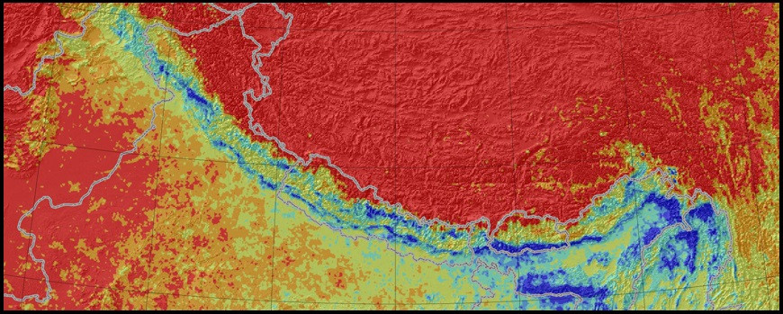
This English-language master’s degree program focuses on the gathering, processing, analysing, and presentation of geoscientific spatial data by using remote-sensing technologies and data-processing methods. The program uses models and theories to assess geoinformation, and then to prepare and communicate our findings with modern means of visualization.
| Name | Remote Sensing, geoInformation and Visualization |
| Degree | Master of Science |
| Standard period of study | 4 semesters |
| Credit points | 120 |
| Language of instruction | English |
| Start of study (1st semester) | Winter semester |
| Campus | Golm |
| Fees & Charges | Semester fees and charges: yes Tuition fees: no |
- PROGRAM FLYER (PDF 269KB)
Program Content
In the Remote Sensing, geoInformation and Visualization master's degree program, you will develop an advanced understanding of remote sensing in theory and practice. The program begins by addressing fundamental principles in the recording and processing of spatial data as they are typically gathered by means of remote sensing methodologies. The program teaches advanced scientific principles of physics, chemistry, and biology to quantify environmental process, the recording of remote sensing data and their interaction with the environment, as well as practical skills in the application of modern data processing methods. The program will grant you an overview of the broad range of available remote sensing technologies and data-processing methodologies. You will learn how to apply these technologies and methods to specific problems in scientific and applied scenarios.
We use modern data visualization tools to prepare our data, for example in the generation of prognoses, scientific communication, and the comprehensible presentation of data to representatives from other disciplines as well as non-specialist decision-makers. The program thereby offers a comprehensive, interdisciplinary understanding of, as well as a critical perspective towards, the solution and evaluation of geoscientific questions.
Course Objective and Future Career Options
In addition to application-oriented specialist knowledge in the fields of remote sensing, geoinformation and visualization, a Master of Science degree in our field puts you in a position to define scientific problems, formulate suitable hypotheses, design research projects, to apply for funding, and to administer scientific projects.
Future fields of work include positions in public administration, such as in municipal, regional and land use planning; natural disaster management and response, as well as environmental monitoring; research in the university and in institutions outside universities. Diverse employment opportunities are also possible in the IT industry, for example in software development in the field of digital mapping; in the insurance and real estate industry; the construction industry; the transportation industry; and in the leisure and tourism sectors.
„This new international degree program, established at one of Germany’s leading geoscientific research universities and research centers, combines geological remote sensing with geoinformation systems and visualization to clearly communicate scientific results.“
Prerequisites for Admission to the Master’s Program
Admission to the Remote Sensing, geoInformation and Visualization master’s degree program requires a qualifying university degree in the field of the geosciences, geography, physics, mathematics, biology, environmental sciences, information science, or a similar program of study with a standard period of study of at least three years and a total share of at least 36 credit points (CP) in the geosciences, biology, physics, chemistry or information science. An additional 12 CP of mathematics coursework as well as 12 CP of geosciences coursework must also be documented. Moreover, your English language skills must correspond at least to the B2 level of the Common European Framework of Reference for Languages (CEFR). Applicants who are not a German citizen must demonstrate sufficient German language proficiency corresponding to the level A2 (CEFR).
You can read more about the subject-specific admission requirements in the respective Admission Regulations.
Program Structure
In the four-semester master’s program, you will earn a total of 120 credit points, consisting of the following modules and your master’s thesis: For additional information, please consult the subject-specific Degree Regulations or the Departmental Advisory Office.
Modules | Credit points |
|---|---|
| Mandatory modules | 30 CP |
Remote Sensing of the Environment Earth System Science Data Analysis and Statistics Geoinformation Systems Visualization and Communication | 6 CP 6 CP 6 CP 6 CP 6 CP |
Elective modules | 60 CP |
1. „Remote Sensing Methods“ (RSM) electives 2. „Objects of Observation“ (OBS) electives 3. „Data Analysis and Programming“ (DAP) electives 4. „Geoinformation Systems and Applications“ (GIS) electives 5. „Visualization and Communication Methods“ (VCM) electives | |
| Master’s Thesis, including Oral Defense | 30 CP |
| Total | 120 CP |
Advantages at a Glance
The Remote Sensing, geoInformation and Visualization master's degree program at the University of Potsdam offers a diverse array of opportunities for specialization in the design of custom-made plans for study. Practical components of the program also offer you the opportunity to acquire professional and research-oriented competences, thereby facilitating a smoother entry into your future career. Our close cooperation with industry and research institutions both in Germany and abroad – such as the nearby Helmholtz Center Potsdam - Research Center for Geosciences, Potsdam Institute for Climate Impact Research, Institute for Advanced Sustainability Studies and the Alfred Wegener Institute of Potsdam – also contributes to this effort.
The University of Potsdam takes into account the actual living conditions of its students and has introduced the possibility of part-time study for many degree programs. This also pertains to the Remote Sensing, geoInformation and Visualization program. To learn more, and to find a list of subjects appropriate for part-time study, please see part-time study at the University of Potsdam.
Application
Have you decided to study the English-language master’s degree in Remote Sensing, geoInformation and Visualization at the University of Potsdam? Then you should take the next step on the application pages to find out more about current application and enrollment procedures.
Contact
Institute of Geosciences
Prof. Dr. Bodo Bookhagen | Departmental Student Advisor & Chair of Examination Board
Campus Golm
Building 27, Room 1.39
This description is based in part on information from the subject-specific regulations for a master’s degree in Remote Sensing, geoInformation and Visualizationat the University of Potsdam dated February 15, 2017 (AmBek No. 13/17, p. 562).
